-40%
1712 J Senex & W Whiston Large Antique Astronomy Print of Planets & Solar System
$ 448.8
- Description
- Size Guide
Description
contact usebay profile
ebay store
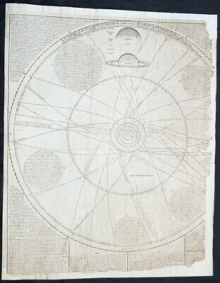
A Scheme of the Solar System with the Orbits of the Planets and Comets belonging thereto, Described from Dr. Halley\'s accurate Table of Comets Philosoph, Transact. No. 297. Founded on Sr. Isaac Newton\'s wonderful discoveries By Wm. Whiston M.A.
Cartographer :
- Senex, John 1690- 1740
Date:
- 1712
Size:
- 27in x 21in (585mm x 520mm)
Ref#:
- 80773
Condition:
- (B) Good Condition
Description:
This large original important copper plate engraved antique map of the Planets & Solar System according to Edmund Halley, Isaac Newton & William Whiston by John Senex in 1712, was published in his Elephant Folio Atlas.
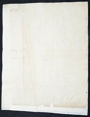
This map is rare and is unfortunately damaged, not unusual for these large maps. Approx 4in strip from the left side of the map & approx 1in from the bottom of the map is missing and has been mounted on contemporary 18th century paper. Still the majority of the map remains and is still a fascinating look into our knowledge of Solar System at the beginning of the 18th century. At the moment there a couple for sale online selling for between 00 - 00
General Definitions:
Paper thickness and quality: - Heavy and stable
Paper color : - off white
Age of map color: -
Colors used: -
General color appearance: -
Paper size: - 27in x 21in (585mm x 520mm)
Plate size: - 27in x 21in (585mm x 520mm)
Margins: - Min 1/2in (12mm)
Imperfections:
Margins: - Approx 4in strip from the left side of the map is missing
Plate area: - Two repairs to top of image
Verso: - Repairs as noted
Background:
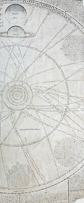
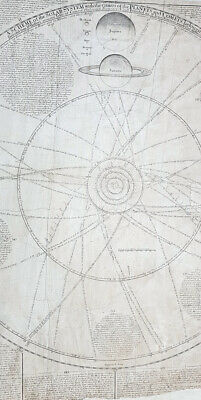
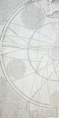
A large and impressive chart of the solar system, paying particular attention to the motions of the planetary bodies and the paths of comets. The chart was originally engraved in 1712 by Senex to accompany the lectures of the controversial theologian, astronomer, and polymath William Whiston. The chart was issued again in 1720 by Senex alone, and finally by Bowles and Sayer in the 1760s. The System is shown as a number of concentric orbits with the Sun at centre, criss-crossed by the broad elliptical paths of a number of comets. At top, the planets are shown pictorially, clumped together in an attempt to demonstrate scale. As the chart was engraved at the beginning of the eighteenth century, the outer planets past Saturn are not included. Earths moon is accorded an honorary spot among the planets, while the moons of the other planets are shown in the grand scheme as Satellites. The alchemical symbols for the zodiac are included along the outside ring of the System, and the chart is absolutely covered by explanatory text.
William Whiston
(1667-1752) was an English mathematician, theologian, historian and religious writer. Born in Leicestershire, Whiston was a leading figure in popularising the ideas of Sir Issac Newton, who was his mentor and teacher. Whiston was a professor of mathematics at the University of Cambridge but was expelled from his position in 1710 due to his unorthodox religious beliefs and views. Whiston was a believer of Arianism, the idea that Christ is subordinate to God, the concept of Christ is based on the belief that the Son of God did not always exist but was begotten by God the Father. He also rejected the notion of eternal torment in hellfire. What especially placed him against church authorities, was he viewed the Trinity as a lie after extensive personal research convinced him the origin of the Trinity teaching to be pagan. Whiston wrote A New Theory of the Earth, published in 1696, in which he presented a description of the divine creation of the Earth, postulating that the earth originated from the atmosphere of a comet.
Senex, John 1690- 1740
Senex was an English cartographer, engraver and explorer.
He was also an astrologer, geologist, and geographer to Queen Anne of Great Britain, editor and seller of antique maps and most importantly creator of the pocket-size map of the world. He owned a business on Fleet Street, where he sold maps.
He was one of the principal cartographers of the 18th century. He started his apprenticeship with Robert Clavell, at the Stationers Company, in 1692. Senex is famous for his maps of the world, some of which have added elevations, and which feature minuscule detailed engravings. Many of these maps can be found in museum collections; rarely, copies are available for private sale. Some copies are held in the National Maritime Museum; many of his maps are now in the possession of Trinity College Dublin. Having worked and collaborated with Charles Price, Senex created a series of engravings for the London Almanacs and in 1714 he published together with Maxwell an English Atlas. In 1719 he published a miniature edition of Brittania by Ogilby. He became particularly interested in depicting California as an island instead of part of mainland North America, a trait which makes many of his maps appealing to collectors. In 1721 he published a new general atlas. He used the work of cartographer Guillaume de LIsle as an influence.
In 1728 Senex was elected into the Fellowship of the Royal Society of London.
Please note all items auctioned are genuine, we do not sell reproductions. A Certificate of Authenticity (COA) can be issued on request.
What is an Antique Map
The word Antique in the traditional sense refers to an item that is more than a hundred years old. In the past maps were sold in two forms, as a single sheet (broadsheet) or bound in an atlas or book. The majority of antique maps for sale today come from books or atlases and have survived due to the protection offered by the hardback covers.
When considering a purchase
The first thing to determine when staring a collection or purchasing an item, is what is important to you. Most collectors prefer to build their collections around a theme. You may decide to collect maps from one region or country, charting its development through time. Similarly you could collect maps of one particular period in time, by type (i.e. sea or celestial charts) or by cartographer. The collector might also want to consider the theme of cartographical misconceptions such as California as an island or Australia as Terra Australis or the Great Southern Land.
The subject is so wide that any would-be-collector has almost endless possibilities to find his own little niche within the field, and thereby build a rewarding collection.
Starting a collection & pricing
Pricing is based on a number of different factors, the most important of which is regional. In any series of maps the most valuable are usually the World Map and the America/North America. The World because it is usually the most decorative and America because it has the strongest regional market. Other factors that come into play re: price is rarity, age, size, historical importance, decorative value (colour) and overall condition and quality of paper it is printed on.
As specialised dealers, we frequently work with first time map buyers who are just starting their collection. Guiding new collectors on their first antique map purchase and helping new collectors to focus their interests is one of the most rewarding aspects of being an rare map dealer. So please do not hesitate to contact us and we will be happy to help with any questions you may have.
Payment, Shipping & Return Options
Please click on the \"Shipping and Payments\" Tab above for shipping, payment and return details
About US
Classical Images was founded 1998 and has built an excellent reputation for supplying high quality original antiquarian maps, historical atlases, antique books and prints. We carry an extensive inventory of antiquarian collectibles from the 15th to 19th century. Our collection typically includes rare books and decorative antique maps and prints by renowned cartographers, authors and engravers. Specific items not listed may be sourced on request.
Classical Images adheres to the Codes of Ethics outlined by the Antiquarian Booksellers Association of America (ABAA).
We are a primarily an online based enterprise, however our inventory may be viewed by appointment. Please call or email to arrange a viewing.
The complete eBay Selling Solution.
Track Page Views With
Auctiva's FREE Counter
